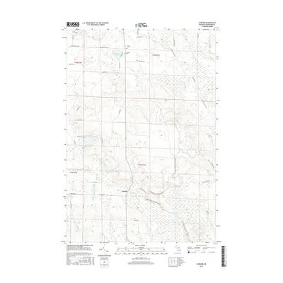
2017 Map of Legrand
USGS Topo · Published 2017About this map
Legrand occupies a central position within this northern Michigan landscape, where the headwaters of several drainages converge. The map documents a complex hydrological network including the N Br Little Pigeon River and Middle Br Little Pigeon River, alongside named seasonal flows like Stoney Creek and Morrow Cr. Local history is anchored by specific markers of early inhabitants, such as the Johnson Grave and Devereaux Grave located near the northern boundary. The terrain is further defined by its recreational and transit infrastructure, featuring the N Eastern State Trail cutting diagonally across the northeastern sections. These features, combined with water bodies like Devereaux Lake and Silver Lake, illustrate a region defined by its wooded wetlands and a grid of rural roads such as Michigan State Rd and W Ostrander Rd.
Find a feature on this map
54 named features on this map. Tap any name to fly to it.
Don’t see what you’re looking for? This feature index may not catch every label — zoom into the map to look around manually.
Map Details
Editions of this 2017 Legrand Map
This is the sole edition of this map. No revisions or reprints were ever made.
Other maps of this area

1955 · Cheboygan
USGS Topo · 1:250,000

1957 · Tower
USGS Topo · 1:62,500

1957 · Wolverine
USGS Topo · 1:62,500

1957 · Cheboygan
USGS Topo · 1:62,500

1957 · Mullett Lake
USGS Topo · 1:62,500

1958 · Cheboygan
USGS Topo · 1:250,000

1982 · Petoskey
USGS Topo · 1:100,000

1982 · Aloha
USGS Topo · 1:25,000
1982 · Mullett Lake
USGS Topo · 1:25,000
1982 · Manning
USGS Topo · 1:25,000