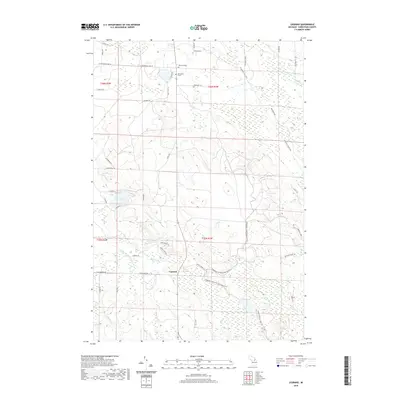
2019 Map of Legrand
USGS Topo · Published 2019About this map
The settlement of Legrand serves as a central point in this 2019 survey of Cheboygan County, where a complex network of waterways and trails defines the landscape. Genealogical researchers may find significant value in the remote burial sites of the Devereaux Grave and Johnson Grave, which stand as solitary landmarks amidst the heavy wetland and forest cover. The area is heavily intersected by recreational and historical routes, including the N Eastern State Trail and the Tomahawk to Red Bridge MCCCT, suggesting a region transition from a utilitarian rail-and-logging past to modern recreational use.
Find a feature on this map
53 named features on this map. Tap any name to fly to it.
Don’t see what you’re looking for? This feature index may not catch every label — zoom into the map to look around manually.
Map Details
Editions of this 2019 Legrand Map
This is the sole edition of this map. No revisions or reprints were ever made.
Other maps of this area

1955 · Cheboygan
USGS Topo · 1:250,000

1957 · Tower
USGS Topo · 1:62,500

1957 · Wolverine
USGS Topo · 1:62,500

1957 · Cheboygan
USGS Topo · 1:62,500

1957 · Mullett Lake
USGS Topo · 1:62,500

1958 · Cheboygan
USGS Topo · 1:250,000

1982 · Petoskey
USGS Topo · 1:100,000

1982 · Aloha
USGS Topo · 1:25,000
1982 · Mullett Lake
USGS Topo · 1:25,000
1982 · Manning
USGS Topo · 1:25,000