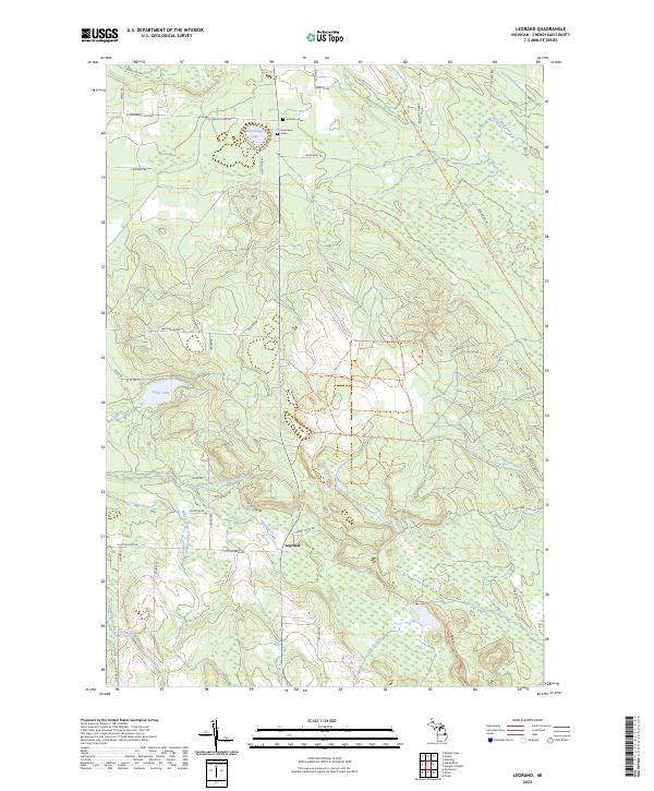
2023 Map of Legrand
USGS Topo · Published 2023About this map
Legrand serves as the focal point of this northern Michigan landscape, situated where the Middle Branch Little Pigeon River and Morrow Creek join the larger Little Pigeon River system. The geography is defined by a dense network of watercourses, including Stony Creek and Adair Creek, which drain the varied terrain of Cheboygan County. In the northern reaches, the North Eastern State Trl follows an established corridor through the woodlands, passing east of Devereaux Lake. For those researching local family history, several markers of early settlement remain, such as the Johnson Grave and Devereaux Grave located near the intersection of W Slater Rd and E Slater Rd. The map also details Silver Lake and its tributary, Silver Creek, illustrating the extensive riparian network that has long shaped the area's development and recreation.
Find a feature on this map
55 named features on this map. Tap any name to fly to it.
Don’t see what you’re looking for? This feature index may not catch every label — zoom into the map to look around manually.
Map Details
Editions of this 2023 Legrand Map
This is the sole edition of this map. No revisions or reprints were ever made.
Other maps of this area

1955 · Cheboygan
USGS Topo · 1:250,000

1957 · Tower
USGS Topo · 1:62,500

1957 · Wolverine
USGS Topo · 1:62,500

1957 · Cheboygan
USGS Topo · 1:62,500

1957 · Mullett Lake
USGS Topo · 1:62,500

1958 · Cheboygan
USGS Topo · 1:250,000

1982 · Petoskey
USGS Topo · 1:100,000

1982 · Aloha
USGS Topo · 1:25,000
1982 · Mullett Lake
USGS Topo · 1:25,000
1982 · Manning
USGS Topo · 1:25,000