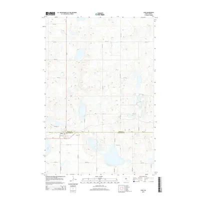
2014 Map of Lehr
USGS Topo · Published 2014About this map
Lehr sits at the intersection of ND-30 and ND-13, straddling the border between Logan Co and Mcintosh Co. This landscape is defined by the prairie pothole region, where numerous small wetlands and basins punctuate the topography. To the south of the primary settlement, the significant expanse of Mud Lake dominates the local drainage pattern, surrounded by a network of sectional roads such as 79th St SE and 80th St SE.
Find a feature on this map
18 named features on this map. Tap any name to fly to it.
Don’t see what you’re looking for? This feature index may not catch every label — zoom into the map to look around manually.
Map Details
Editions of this 2014 Lehr Map
This is the sole edition of this map. No revisions or reprints were ever made.
Other maps of this area

1953 · Jamestown
USGS Topo · 1:250,000

1956 · Jamestown
USGS Topo · 1:250,000

1982 · Coldwater Lake NW
USGS Topo · 1:24,000

1982 · Fredonia NW
USGS Topo · 1:24,000

1982 · Guyson
USGS Topo · 1:24,000

1982 · Danzig
USGS Topo · 1:24,000

1982 · Lehr NW
USGS Topo · 1:24,000

1982 · Lehr NE
USGS Topo · 1:24,000

1982 · Ashley NE
USGS Topo · 1:24,000

1982 · Lehr SW
USGS Topo · 1:24,000