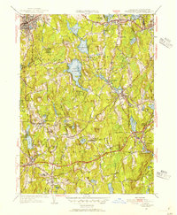
1953 Map of Leicester
USGS Topo · Published 1954About this map
Spencer and Leicester serve as the primary hubs in this central Massachusetts landscape, where the terrain is defined by a dense network of ponds and glacial hills. The 1953 revision shows a region balancing early industrial settlements like Rochdale and North Oxford with significant institutional and conservation lands. Notable sites include the Clara Barton Home near the Oxford town line and the expansive Spencer State Forest wrapping around Stiles Reservoir. The influence of early transportation is evident in the path of the Boston and Albany RR and historical routes like the Boston and Albany Turnpike. Genealogists may find value in the various burial grounds such as Gore Cem and Bay Path Cem, while several institutional landmarks like the Water Tanks Masonic Home and the Charlton Home Farm reflect the social history of the era.
Find a feature on this map
89 named features on this map. Tap any name to fly to it.
Don’t see what you’re looking for? This feature index may not catch every label — zoom into the map to look around manually.
Map Details
Editions of this 1953 Leicester Map
3 editions found
Other maps of this area

1885 · Worcester
USGS Topo · 1:62,500

1886 · Worcester
USGS Topo · 1:62,500

1887 · Brookfield
USGS Topo · 1:62,500

1887 · Barre
USGS Topo · 1:62,500

1889 · Webster
USGS Topo · 1:62,500

1889 · Barre
USGS Topo · 1:62,500

1890 · Brookfield
USGS Topo · 1:62,500

1892 · Webster
USGS Topo · 1:62,500

1892 · Worcester
USGS Topo · 1:62,500

1893 · Brookfield
USGS Topo · 1:62,500