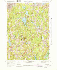
1969 Map of Leicester
USGS Topo · Published 1979About this map
Spencer State Forest dominates the northwestern corner of this Worcester County landscape, a region defined by its numerous glacial ponds and the industrial heritage of its river valleys. In Leicester, the village centers of Cherry Valley and Rochdale sit amongst higher elevations like Denny Hill, while institutional presence is marked by Junior College and Leicester High Sch. To the south, the Mass Turnpike cuts a modern path across older corridors of travel, passing near Northside and the headwaters of the French River. The southern settlements of Charlton City and Charlton maintain distinct identities, with local genealogy interests anchored by Westridge Cem and Bay Path Cem. Industrial activity is evident in the Gravel Pit near Morseville and the Conrail line serving the textile-mill towns of the era. Significant water bodies like Stiles Reservoir and the flood control area at Buffumville Lake shape the local drainage and recreation patterns.
Find a feature on this map
98 named features on this map. Tap any name to fly to it.
Don’t see what you’re looking for? This feature index may not catch every label — zoom into the map to look around manually.
Map Details
Editions of this 1969 Leicester Map
3 editions found
Other maps of this area

1885 · Worcester
USGS Topo · 1:62,500

1886 · Worcester
USGS Topo · 1:62,500

1887 · Brookfield
USGS Topo · 1:62,500

1887 · Barre
USGS Topo · 1:62,500

1889 · Webster
USGS Topo · 1:62,500

1889 · Barre
USGS Topo · 1:62,500

1890 · Brookfield
USGS Topo · 1:62,500

1892 · Webster
USGS Topo · 1:62,500

1892 · Worcester
USGS Topo · 1:62,500

1893 · Brookfield
USGS Topo · 1:62,500