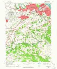
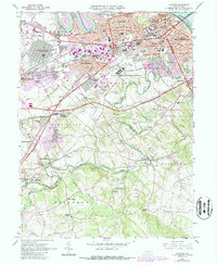
1963 Map of Lemoyne
USGS Topo · Published 1965About this map
Yellow Breeches Creek winds through the southern landscape of this 1963 survey, serving as a boundary between Upper Allen, Lower Allen, and Fairview townships. The map documents a period of significant suburban expansion and institutional presence across Cumberland County, anchored by the massive US Naval Reservation and the State Correctional Institution. This era saw the growth of neighborhoods like Rossmoyne and Drexel Hills alongside established centers such as Lemoyne and New Cumberland. The transportation corridor is dominated by the Pennsylvania Turnpike and Reading rail lines, which facilitated the region's industrial and residential density. Further south, the map reveals a more rural character near Grantham, where Messiah College is situated, and small agrarian clusters like Siddonsburg and Lisburn. Notable local landmarks include Skyport Airfield and the Methodist Home for Children, providing a detailed view of the community's mid-century social and economic fabric.
Find a feature on this map
93 named features on this map. Tap any name to fly to it.
Don’t see what you’re looking for? This feature index may not catch every label — zoom into the map to look around manually.
Map Details
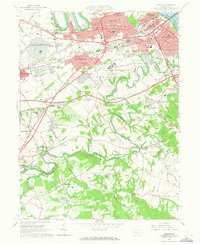
Editions of this 1963 Lemoyne Map
5 editions found
Other maps of this area

1892 · Harrisburg
USGS Topo · 1:62,500

1899 · Harrisburg
USGS Topo · 1:62,500

1904 · Carlisle
USGS Topo · 1:62,500

1906 · New Cumberland
USGS Topo · 1:62,500

1907 · New Bloomfield
USGS Topo · 1:62,500

1924 · Harrisburg
USGS Topo · 1:62,500

1943 · New Cumberland
USGS Topo · 1:62,500

1943 · Harrisburg
USGS Topo · 1:62,500

1943 · New Bloomfield
USGS Topo · 1:62,500

1943 · Carlisle
USGS Topo · 1:62,500