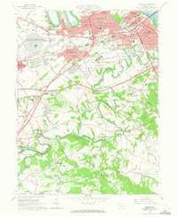
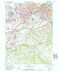
1963 Map of Lemoyne
USGS Topo · Published 1971About this map
The US Naval Reservation (Mechanicsburg Supply Depot) dominates the northern landscape of this 1963 survey, illustrating the significant military and logistics presence in Cumberland County during the Cold War. The map details the suburban expansion of Lemoyne, Camp Hill, and Shiremanstown as they developed toward the Pennsylvania Turnpike and the Harrisburg Expressway. Southward, the character shifts toward more dispersed settlements like Lisburn and Siddonsburg, following the winding course of Yellow Breeches Creek. This waterway serves as the boundary between Cumberland and York counties, passing by landmarks such as Messiah College and the State Correctional Institution. Significant local history and genealogy markers are visible, including the Lantz Cem, Methodist Home for Children, and numerous rural schools like Mt Zion Sch. The mapping also preserves the locations of early industries such as Eberlys Mill and various quarries, contrasting with newer infrastructure like the Skyport Airfield.
Find a feature on this map
87 named features on this map. Tap any name to fly to it.
Don’t see what you’re looking for? This feature index may not catch every label — zoom into the map to look around manually.
Map Details
Editions of this 1963 Lemoyne Map
5 editions found
Other maps of this area

1892 · Harrisburg
USGS Topo · 1:62,500

1899 · Harrisburg
USGS Topo · 1:62,500

1904 · Carlisle
USGS Topo · 1:62,500

1906 · New Cumberland
USGS Topo · 1:62,500

1907 · New Bloomfield
USGS Topo · 1:62,500

1924 · Harrisburg
USGS Topo · 1:62,500

1943 · New Cumberland
USGS Topo · 1:62,500

1943 · Harrisburg
USGS Topo · 1:62,500

1943 · New Bloomfield
USGS Topo · 1:62,500

1943 · Carlisle
USGS Topo · 1:62,500