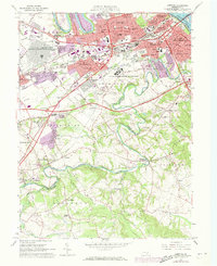
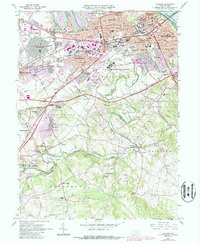
1963 Map of Lemoyne
USGS Topo · Published 1973About this map
Yellow Breeches Creek winds through the heart of this landscape, serving as the boundary between Cumberland and York Counties. The early 1960s suburban expansion of the Harrisburg area is evident, with developing neighborhoods like Rossmoyne Manor and Winding Heights appearing alongside established boroughs such as Camp Hill and Lemoyne. The area's strategic location is underscored by the convergence of the Penn Central and Reading railroads, as well as the major thoroughfares of the Pennsylvania Turnpike and Simpson Ferry Road.
Find a feature on this map
76 named features on this map. Tap any name to fly to it.
Don’t see what you’re looking for? This feature index may not catch every label — zoom into the map to look around manually.
Map Details
Editions of this 1963 Lemoyne Map
5 editions found
Other maps of this area

1892 · Harrisburg
USGS Topo · 1:62,500

1899 · Harrisburg
USGS Topo · 1:62,500

1904 · Carlisle
USGS Topo · 1:62,500

1906 · New Cumberland
USGS Topo · 1:62,500

1907 · New Bloomfield
USGS Topo · 1:62,500

1924 · Harrisburg
USGS Topo · 1:62,500

1943 · New Cumberland
USGS Topo · 1:62,500

1943 · Harrisburg
USGS Topo · 1:62,500

1943 · New Bloomfield
USGS Topo · 1:62,500

1943 · Carlisle
USGS Topo · 1:62,500