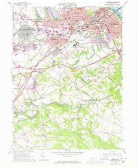
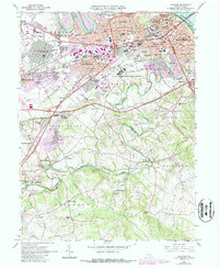
1963 Map of Lemoyne
USGS Topo · Published 1972About this map
Yellow Breeches Creek carves a winding path across this landscape, serving as the boundary between Cumberland Co and York Co. This mid-century survey illustrates the intense suburbanization radiating from Harrisburg's western banks, with growing residential developments like Washington Heights, Cedar Cliff, and Winding Heights filling the gaps between established boroughs. The Reading System and Penn Central rail lines converge near Lemoyne and New Cumberland, highlighting the area's role as a critical transportation corridor near the Susquehanna River.
Find a feature on this map
85 named features on this map. Tap any name to fly to it.
Don’t see what you’re looking for? This feature index may not catch every label — zoom into the map to look around manually.
Map Details
Editions of this 1963 Lemoyne Map
5 editions found
Other maps of this area

1892 · Harrisburg
USGS Topo · 1:62,500

1899 · Harrisburg
USGS Topo · 1:62,500

1904 · Carlisle
USGS Topo · 1:62,500

1906 · New Cumberland
USGS Topo · 1:62,500

1907 · New Bloomfield
USGS Topo · 1:62,500

1924 · Harrisburg
USGS Topo · 1:62,500

1943 · New Cumberland
USGS Topo · 1:62,500

1943 · Harrisburg
USGS Topo · 1:62,500

1943 · New Bloomfield
USGS Topo · 1:62,500

1943 · Carlisle
USGS Topo · 1:62,500