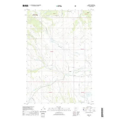
2020 Map of Lennep
USGS Topo · Published 2020About this map
Lennep serves as the central focal point of this mountainous landscape in Meagher County, where the plains meet the foothills of the Lewis & Clark National Forest. The settlement is situated near the S Fork Musselshell River, with the Lennep Cem nearby. The terrain is defined by dramatic drainage systems, including Slaughter House Cr and Robinson Cr, which flow toward the lower elevations. Local water management is evident at Bonanza Reservoir and Voldseth Reservoir.
Find a feature on this map
37 named features on this map. Tap any name to fly to it.
Don’t see what you’re looking for? This feature index may not catch every label — zoom into the map to look around manually.
Map Details
Editions of this 2020 Lennep Map
This is the sole edition of this map. No revisions or reprints were ever made.
Other maps of this area

1886 · Little Belt Mts.
USGS Topo · 1:250,000

1894 · Little Belt Mts.
USGS Topo · 1:250,000

1897 · Little Belt Mts.
USGS Topo · 1:250,000

1898 · Little Belt Mts.
USGS Topo · 1:250,000

1902 · Little Belt Mts.
USGS Topo · 1:250,000

1948 · White Sulphur Springs
USGS Topo · 1:250,000

1951 · Hamen
USGS Topo · 1:24,000

1951 · Rimrock Divide
USGS Topo · 1:24,000

1958 · White Sulphur Springs
USGS Topo · 1:250,000

1961 · White Sulphur Springs
USGS Topo · 1:250,000