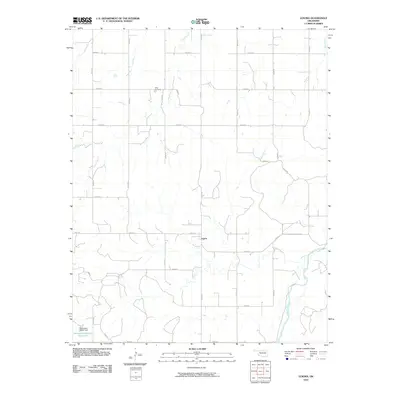
2010 Map of Lenora
USGS Topo · Published 2010About this map
Lenora sits at the center of this Dewey County landscape, where the rural road network reflects the orderly section lines of western Oklahoma. The settlement is positioned north of the winding Canadian River, which cuts across the southeastern corner of the quadrangle. Water management is a defining characteristic of the local geography, visible in the presence of the Oknoname 043001 Reservoir and its associated Oknoname 043001 Dam to the southwest. To the north, Riley Cemetery provides a specific point of interest for genealogists tracing families from this prairie region. The terrain is further defined by the drainages of Camp Creek and Deep Creek, which navigate the elevation changes between the upland plains and the river valley. This 2010 edition illustrates the enduring structure of the local farming and ranching economy through its established grid of named county roads.
Find a feature on this map
24 named features on this map. Tap any name to fly to it.
Don’t see what you’re looking for? This feature index may not catch every label — zoom into the map to look around manually.
Map Details
Editions of this 2010 Lenora Map
This is the sole edition of this map. No revisions or reprints were ever made.
Other maps of this area

1955 · Clinton
USGS Topo · 1:250,000

1955 · Woodward
USGS Topo · 1:250,000

1957 · Clinton
USGS Topo · 1:250,000

1958 · Woodward
USGS Topo · 1:250,000

1962 · Putnam
USGS Topo · 1:62,500

1962 · Aledo
USGS Topo · 1:62,500

1969 · Mutual SW
USGS Topo · 1:24,000

1969 · Mutual
USGS Topo · 1:24,000

1969 · Lenora
USGS Topo · 1:24,000

1969 · Mutual NE
USGS Topo · 1:24,000