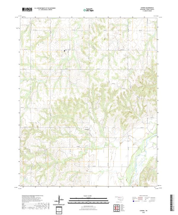
2022 Map of Lenora
USGS Topo · Published 2022About this map
Lenora sits at the center of this rural Oklahoma landscape, where the township grid of t18n r18w meets the undulating terrain of northwestern Dewey County. The geography is defined by the drainage patterns of Camp Cr and Deep Cr, which carve through the plains toward the broad bed of the Canadian River in the southeast corner. This region maintains a distinctly agrarian character, evidenced by the dense network of section-line roads like e0670 RD and n2210 RD that partition the land into traditional square-mile blocks.
Find a feature on this map
29 named features on this map. Tap any name to fly to it.
Don’t see what you’re looking for? This feature index may not catch every label — zoom into the map to look around manually.
Map Details
Editions of this 2022 Lenora Map
This is the sole edition of this map. No revisions or reprints were ever made.
Other maps of this area

1955 · Clinton
USGS Topo · 1:250,000

1955 · Woodward
USGS Topo · 1:250,000

1957 · Clinton
USGS Topo · 1:250,000

1958 · Woodward
USGS Topo · 1:250,000

1962 · Putnam
USGS Topo · 1:62,500

1962 · Aledo
USGS Topo · 1:62,500

1969 · Mutual SW
USGS Topo · 1:24,000

1969 · Mutual
USGS Topo · 1:24,000

1969 · Lenora
USGS Topo · 1:24,000

1969 · Mutual NE
USGS Topo · 1:24,000