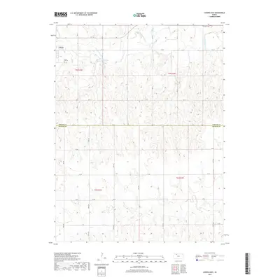
2018 Map of Lenora East
USGS Topo · Published 2018About this map
Lenora sits at the edge of this landscape where the N Fork Solomon River winds through the northern plains of Norton County. The area is defined by a dense network of watercourses, including the central Norton County Lake and the branching tributaries of Lost Cr, Elk Cr, and E Elk Cr. To the south, the terrain transitions into the drainage basin of Bow Cr as it crosses into Graham County. Local history is anchored by the presence of the Lenora East Cem just outside the town limits and the remote Modell Cem further east. The map detail reflects a strictly surveyed agricultural grid, with section lines marked by roads such as RD A A and RD B B, illustrating the persistent rural structure of this Kansas borderland.
Find a feature on this map
34 named features on this map. Tap any name to fly to it.
Don’t see what you’re looking for? This feature index may not catch every label — zoom into the map to look around manually.
Map Details
Editions of this 2018 Lenora East Map
This is the sole edition of this map. No revisions or reprints were ever made.
Other maps of this area

1893 · Norton
USGS Topo · 1:125,000

1893 · Hill
USGS Topo · 1:125,000

1954 · Goodland
USGS Topo · 1:250,000

1955 · Beloit
USGS Topo · 1:250,000

1956 · Goodland
USGS Topo · 1:250,000

1957 · Goodland
USGS Topo · 1:250,000

1959 · Beloit
USGS Topo · 1:250,000

1978 · Edmond
USGS Topo · 1:24,000

1978 · Lenora East
USGS Topo · 1:24,000

1978 · Lenora West
USGS Topo · 1:24,000