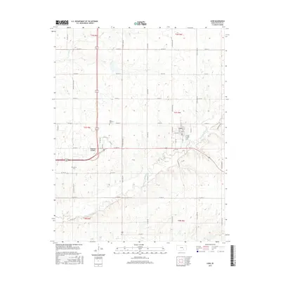
2015 Map of Leon
USGS Topo · Published 2015About this map
Leon serves as the primary hub of this eastern Butler County landscape, situated near the winding course of the Little Walnut River. The town's grid is clearly defined by streets like N Main St and W Mechanic St, illustrating a classic Kansas prairie settlement pattern. This area is a significant resource for genealogical research, as it preserves the locations of several distinct burial grounds, including the Leon Cem just south of town and the family-named Butts - Wakefield Cem to the northwest. Beyond the town limits, the terrain is marked by a network of rural routes such as SE Bluestem Rd and SE Teter Rd that traverse the rolling hills. Small watercourses like Turkey Cr feed into the river system, which dictates the layout of regional thoroughfares and the positioning of rural outposts like Pickrell Corner.
Find a feature on this map
52 named features on this map. Tap any name to fly to it.
Don’t see what you’re looking for? This feature index may not catch every label — zoom into the map to look around manually.
Map Details
Editions of this 2015 Leon Map
This is the sole edition of this map. No revisions or reprints were ever made.
Other maps of this area

1888 · Eldorado
USGS Topo · 1:125,000

1955 · Wichita
USGS Topo · 1:250,000

1958 · Wichita
USGS Topo · 1:250,000

1961 · Augusta
USGS Topo · 1:24,000

1961 · Pontiac
USGS Topo · 1:24,000

1961 · El Dorado
USGS Topo · 1:24,000

1961 · Gordon
USGS Topo · 1:24,000
1961 · El Dorado SW
USGS Topo · 1:24,000

1963 · Leon
USGS Topo · 1:24,000

1964 · Augusta SE
USGS Topo · 1:24,000