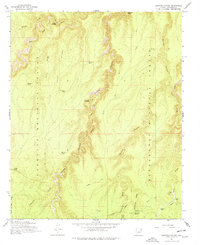
1965 Map of Leonard Canyon
USGS Topo · Published 1978About this map
Leonard Canyon winds through the high plateaus of Coconino County, serving as the central drainage feature for this landscape within the Coconino National Forest and Sitgreaves National Forest. The 1965 field check reveals a backcountry landscape defined by livestock operations and traditional water management, featuring isolated outposts like Wiggins Ranch and Hugh Barr Ranch. Movement through the deep drainages is facilitated by established routes such as the Pack Trail and Soldier Trail, which connect vital water sources like Spaulding Spring and Chavez Spring. The map documents a network of stock tanks including Victorine Tank and Weimer Tank, illustrating the ranching infrastructure required for survival in this arid high-country environment. Historical transit points across the deep draws are marked by Macks Crossing and Fairchild Crossing, indicating where the terrain allowed for passage between the prominent limestone and cart ridges.
Find a feature on this map
36 named features on this map. Tap any name to fly to it.
Don’t see what you’re looking for? This feature index may not catch every label — zoom into the map to look around manually.
Map Details
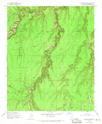
Editions of this 1965 Leonard Canyon Map
2 editions found
Other maps of this area

1886 · Holbrook
USGS Topo · 1:250,000

1887 · Verde
USGS Topo · 1:250,000

1892 · Verde
USGS Topo · 1:250,000

1893 · Holbrook
USGS Topo · 1:250,000

1934 · Promontory Butte
USGS Topo · 1:62,500

1939 · Promontory Butte
USGS Topo · 1:62,500

1952 · Promontory Butte
USGS Topo · 1:62,500

1954 · Holbrook
USGS Topo · 1:250,000

1957 · Holbrook
USGS Topo · 1:250,000

1958 · Holbrook
USGS Topo · 1:250,000