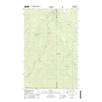
2017 Map of Leonia
USGS Topo · Published 2017About this map
The Leonia settlement sits at a dramatic geographical junction where the Kootenai River crosses the Idaho Montana state line. This borderland landscape is defined by the steep transition from the river valley to high peaks like Clifty Mountain and Timber Mountain. The map reveals a remote mountainous terrain managed largely as federal land, split between the Kaniksu National Forest and the Kootenai National Forest. Local history is anchored at the Boulder Creek Cem, situated near the confluence of Boulder Cr and the river. Numerous mountain drainages, including Gable Cr, Logan Cr, and Star Cr, carve through the ridges, while the local transit network is represented by routes like Leonia Rd and Twentymile Leonia Rd, which follow the natural contours of the river and its tributaries.
Find a feature on this map
35 named features on this map. Tap any name to fly to it.
Don’t see what you’re looking for? This feature index may not catch every label — zoom into the map to look around manually.
Map Details
Editions of this 2017 Leonia Map
This is the sole edition of this map. No revisions or reprints were ever made.
Other maps of this area

1911 · Priest Lake
USGS Topo · 1:250,000

1913 · Priest Lake
USGS Topo · 1:250,000

1920 · Libby
USGS Topo · 1:125,000

1930 · Libby
USGS Topo · 1:125,000

1932 · Libby
USGS Topo · 1:125,000

1951 · Mt Pend Oreille
USGS Topo · 1:62,500

1957 · Kalispell
USGS Topo · 1:250,000

1958 · Sandpoint
USGS Topo · 1:250,000

1960 · Kalispell
USGS Topo · 1:250,000

1961 · Kalispell
USGS Topo · 1:250,000