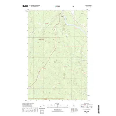
2020 Map of Leonia
USGS Topo · Published 2020About this map
The settlement of Leonia sits at the northern edge of this Idaho-Montana border region, where the Kootenai River carves a deep valley between significant peaks. This modern survey illustrates the complex jurisdictional boundaries of the Cabinet Mountains, marking the intersection of the Kaniksu National Forest and Kootenai National Forest. Notable landmarks such as Clifty Mountain, Timber Mountain, and Leonia Knob dominate the vertical relief of the landscape. Local history is anchored at the Boulder Creek Cem near the confluence of Boulder Cr and the river. The map details a network of forest roads, including Twentymile Leonia Rd and Rocky Draw Rd, which provide access to remote drainages like Prohibition Cr and Camp Cr.
Find a feature on this map
39 named features on this map. Tap any name to fly to it.
Don’t see what you’re looking for? This feature index may not catch every label — zoom into the map to look around manually.
Map Details
Editions of this 2020 Leonia Map
This is the sole edition of this map. No revisions or reprints were ever made.
Other maps of this area

1911 · Priest Lake
USGS Topo · 1:250,000

1913 · Priest Lake
USGS Topo · 1:250,000

1920 · Libby
USGS Topo · 1:125,000

1930 · Libby
USGS Topo · 1:125,000

1932 · Libby
USGS Topo · 1:125,000

1951 · Mt Pend Oreille
USGS Topo · 1:62,500

1957 · Kalispell
USGS Topo · 1:250,000

1958 · Sandpoint
USGS Topo · 1:250,000

1960 · Kalispell
USGS Topo · 1:250,000

1961 · Kalispell
USGS Topo · 1:250,000