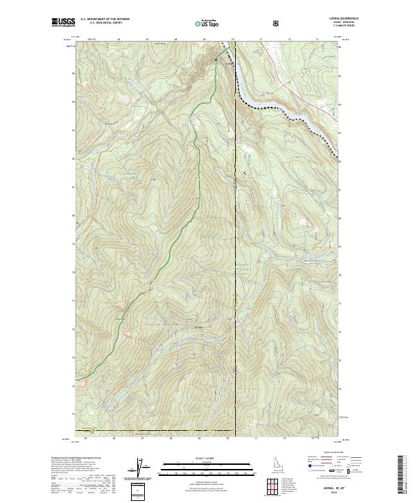
2024 Map of Leonia
USGS Topo · Published 2024About this map
The Kootenai River snakes through the northern reaches of this map, defining the landscape near the small settlement of Leonia. This borderland region, where Idaho and Montana meet at the boundary of Boundary and Lincoln Counties, is dominated by the high peaks of the Cabinet Mountains. Steep drainage systems like Boulder Creek and Star Creek carve through the heavily forested terrain of the Kaniksu National Forest and Kootenai National Forest. The map captures a mix of rugged natural features and essential local markers, such as the Boulder Creek Cem and a network of forest roads and trails including the Clifty Mountain Trl and Timber Mountain Trl. Prominent summits like Timber Mtn, Roberts Mtn, and Leonia Knob provide a clear view of the complex topography that has long challenged and shaped the development of this northern panhandle area.
Find a feature on this map
42 named features on this map. Tap any name to fly to it.
Don’t see what you’re looking for? This feature index may not catch every label — zoom into the map to look around manually.
Map Details
Editions of this 2024 Leonia Map
This is the sole edition of this map. No revisions or reprints were ever made.
Other maps of this area

1911 · Priest Lake
USGS Topo · 1:250,000

1913 · Priest Lake
USGS Topo · 1:250,000

1920 · Libby
USGS Topo · 1:125,000

1930 · Libby
USGS Topo · 1:125,000

1932 · Libby
USGS Topo · 1:125,000

1951 · Mt Pend Oreille
USGS Topo · 1:62,500

1957 · Kalispell
USGS Topo · 1:250,000

1958 · Sandpoint
USGS Topo · 1:250,000

1960 · Kalispell
USGS Topo · 1:250,000

1961 · Kalispell
USGS Topo · 1:250,000