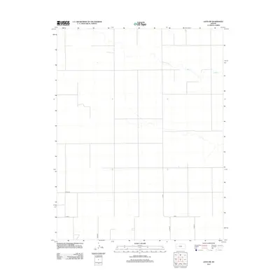
2012 Map of Leoti SW
USGS Topo · Published 2012About this map
The ephemeral course of Sand Cr carves a winding path across the arid High Plains landscape of Wichita County. This 2012 survey reveals the rigid precision of the Public Land Survey System, where a network of section-line roads like Co Road E and Co Road DD define the modern agricultural geography. The map illustrates how human infrastructure adapts to the subtle drainages of the prairie, with corridors such as Co Rd-1 and Co Rd-9 providing the primary framework for local travel between vast agricultural plots. For those studying the evolution of western Kansas land use, the placement of these county routes against the natural flow of the creek provides a clear picture of the rural transportation network in the early 21st century.
Find a feature on this map
7 named features on this map. Tap any name to fly to it.
Don’t see what you’re looking for? This feature index may not catch every label — zoom into the map to look around manually.
Map Details
Editions of this 2012 Leoti SW Map
This is the sole edition of this map. No revisions or reprints were ever made.
Other maps of this area

1955 · Scott City
USGS Topo · 1:250,000

1958 · Scott City
USGS Topo · 1:250,000

1965 · Leoti 3 NW
USGS Topo · 1:24,000

1965 · Leoti 3 NE
USGS Topo · 1:24,000

1966 · Tribune 4 NE
USGS Topo · 1:24,000

1970 · Selkirk SE
USGS Topo · 1:24,000

1970 · Selkirk
USGS Topo · 1:24,000

1970 · Leoti
USGS Topo · 1:24,000

1970 · Lydia
USGS Topo · 1:24,000

1970 · Leoti NW
USGS Topo · 1:24,000