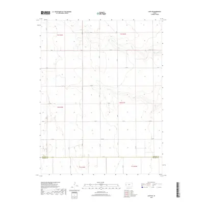
2018 Map of Leoti SW
USGS Topo · Published 2018About this map
Sand Cr carves a winding path through the high plains of western Kansas, defining the topographic character of this rural landscape. Situated along the boundary where Wichita Co meets Kearny Co to the south, the area is organized by an extensive grid of section-line roads such as Co Rd S, Co Rd 1, and Co Rd Y. The map documents a sparsely settled agricultural region, where the dry stream bed of the creek and subtle depressions are the primary natural landmarks. This 2018 survey provides a clear view of the modern land management system, showing how the vast open spaces are partitioned into townships like t20s r37w and t20s r38w. The lack of named towns or structures highlights the remote nature of this portion of the state, focusing instead on the vital transport network represented by numerous county routes including Co Rd AA and Co Rd BB.
Find a feature on this map
24 named features on this map. Tap any name to fly to it.
Don’t see what you’re looking for? This feature index may not catch every label — zoom into the map to look around manually.
Map Details
Editions of this 2018 Leoti SW Map
This is the sole edition of this map. No revisions or reprints were ever made.
Other maps of this area

1955 · Scott City
USGS Topo · 1:250,000

1958 · Scott City
USGS Topo · 1:250,000

1965 · Leoti 3 NW
USGS Topo · 1:24,000

1965 · Leoti 3 NE
USGS Topo · 1:24,000

1966 · Tribune 4 NE
USGS Topo · 1:24,000

1970 · Selkirk SE
USGS Topo · 1:24,000

1970 · Selkirk
USGS Topo · 1:24,000

1970 · Leoti
USGS Topo · 1:24,000

1970 · Lydia
USGS Topo · 1:24,000

1970 · Leoti NW
USGS Topo · 1:24,000