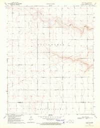
1970 Map of Leoti SW
USGS Topo · Published 1972About this map
Sand Creek winds through the northern landscape of this Western Kansas prairie, defining the drainage patterns in an area characterized by scattered agricultural operations. The terrain labels Whitewoman and West Hibbard denote the local townships, reflecting the rural organization of the High Plains during the early 1970s. This survey, based on 1968 aerial photography, shows a land surface dotted with numerous wells, vital infrastructure for irrigation and ranching in this semi-arid environment.
Find a feature on this map
8 named features on this map. Tap any name to fly to it.
Don’t see what you’re looking for? This feature index may not catch every label — zoom into the map to look around manually.
Map Details
Editions of this 1970 Leoti SW Map
This is the sole edition of this map. No revisions or reprints were ever made.
Other maps of this area

1955 · Scott City
USGS Topo · 1:250,000

1958 · Scott City
USGS Topo · 1:250,000

1965 · Leoti 3 NW
USGS Topo · 1:24,000

1965 · Leoti 3 NE
USGS Topo · 1:24,000

1966 · Tribune 4 NE
USGS Topo · 1:24,000

1970 · Selkirk SE
USGS Topo · 1:24,000

1970 · Selkirk
USGS Topo · 1:24,000

1970 · Leoti
USGS Topo · 1:24,000

1970 · Lydia
USGS Topo · 1:24,000

1970 · Leoti NW
USGS Topo · 1:24,000