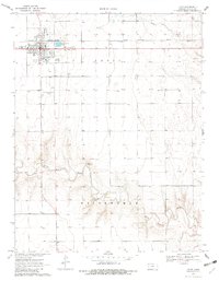
1970 Map of Leoti
USGS Topo · Published 1982About this map
Leoti sits as the central hub of Wichita County during this 1970 survey, defined by its position along the Missouri Pacific railroad. The town plan is clearly detailed, showing the High Sch, County Fairgrounds, and the nearby Mark Hoard Memorial Airfield. South of the settlement, the landscape drops into the drainage basin of White Woman Creek, also labeled in its larger reach as White Woman. The map provides specific local landmarks essential for family history research, such as the County Cem and various radio towers. The surrounding High Plains terrain is marked by a network of field lines and section boundaries, with industrial and infrastructure elements like the Sewage Disposal Ponds and a Pipeline illustrating the mid-century utility footprint of this Kansas plains community.
Find a feature on this map
14 named features on this map. Tap any name to fly to it.
Don’t see what you’re looking for? This feature index may not catch every label — zoom into the map to look around manually.
Map Details
Editions of this 1970 Leoti Map
2 editions found
Other maps of this area

1939 · Pence
USGS Topo · 1:62,500

1941 · Modoc
USGS Topo · 1:62,500

1941 · Pence
USGS Topo · 1:62,500

1951 · Modoc
USGS Topo · 1:62,500

1955 · Scott City
USGS Topo · 1:250,000

1958 · Scott City
USGS Topo · 1:250,000

1968 · Russell Springs 3 SW
USGS Topo · 1:24,000

1968 · Russell Springs 3 SE
USGS Topo · 1:24,000

1970 · Leoti
USGS Topo · 1:24,000

1970 · Lydia
USGS Topo · 1:24,000