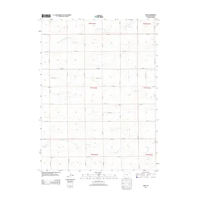
2013 Map of Leroy
USGS Topo · Published 2013About this map
The small community of Leroy serves as the central hub for this high plains landscape in Logan County, characterized by a vast grid of county roads and intermittent waterways. The terrain is defined by the gentle drainage patterns of North Fork Frenchman Creek in the northern sections and Sandy Creek to the south. This 2013 survey illustrates the enduring agricultural structure of the region, where the Public Land Survey System (PLSS) sections are neatly partitioned by a network ranging from Co Road 14 to Co Road 75. For those tracing local history or family roots, the Leroy Cem stands as a significant landmark north of the town site, providing a tangible link to the early families who settled this portion of the Colorado plains. The map's layout highlights the transition between the rolling uplands and the creek beds that vary the otherwise uniform prairie topography.
Find a feature on this map
28 named features on this map. Tap any name to fly to it.
Don’t see what you’re looking for? This feature index may not catch every label — zoom into the map to look around manually.
Map Details
Editions of this 2013 Leroy Map
This is the sole edition of this map. No revisions or reprints were ever made.
Other maps of this area

1951 · Reiradon Hill
USGS Topo · 1:24,000

1951 · Galien
USGS Topo · 1:24,000

1954 · Sterling
USGS Topo · 1:250,000

1958 · Sterling
USGS Topo · 1:250,000

1962 · Fleming
USGS Topo · 1:24,000

1962 · Uhler Ranch
USGS Topo · 1:24,000

1972 · New Haven
USGS Topo · 1:24,000

1972 · Glacken Hill
USGS Topo · 1:24,000

1972 · St Petersburg
USGS Topo · 1:24,000

1972 · Leroy
USGS Topo · 1:24,000