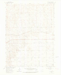
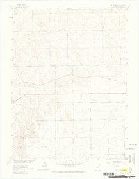
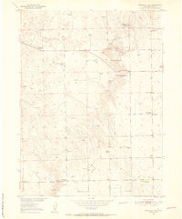
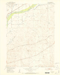
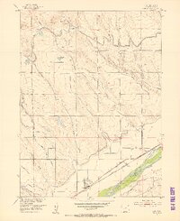
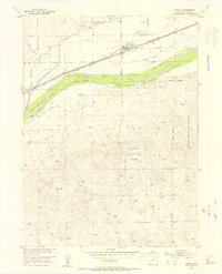
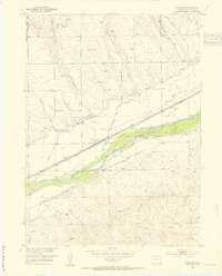
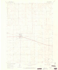
1962 Map of Uhler Ranch
USGS Topo · Published 1964About this map
Uhler Ranch and the surrounding ranchlands of Logan County are depicted here in the early 1960s, a period when this section of northeastern Colorado was undergoing focused development as part of the Missouri River Basin project. The landscape is defined by its vast agricultural utility and growing industrial infrastructure, notably marked by a large-diameter Pipeline and several Drill Holes indicative of period exploration. The small settlement of Proctor sits in the northern reaches of the sheet, while Harmon serves as a local landmark in the southern half. Transportation and logistics are anchored by the Chicago Burlington and Quincy railroad, which cuts across the terrain as a vital link for the region's ranching economy. Local resource extraction is evidenced by scattered Gravel Pits and a Gas Well, illustrating the intersection of traditional land use and post-war energy development.
Find a feature on this map
15 named features on this map. Tap any name to fly to it.
Don’t see what you’re looking for? This feature index may not catch every label — zoom into the map to look around manually.
Map Details
Editions of this 1962 Uhler Ranch Map
3 editions found

Other maps of this area
1951 · Reiradon Hill
USGS Topo · 1:24,000
1951 · Galien
USGS Topo · 1:24,000
1951 · Iliff
USGS Topo · 1:24,000
1953 · Crook
USGS Topo · 1:24,000
1953 · Proctor
USGS Topo · 1:24,000

1954 · Sterling
USGS Topo · 1:250,000

1958 · Sterling
USGS Topo · 1:250,000
1962 · Fleming
USGS Topo · 1:24,000

1972 · St Petersburg
USGS Topo · 1:24,000

1972 · Leroy
USGS Topo · 1:24,000