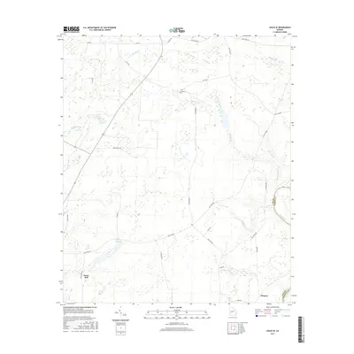
2017 Map of Leslie SE
USGS Topo · Published 2017About this map
Mossy Dell and the surrounding agricultural lands of the Lee and Worth county line are defined by a complex network of wetlands and small tributaries feeding toward the Flint River. This 2017 survey shows a landscape dominated by intermittent water features and named drainage branches, including White Oak Br and the lengthy Hawkins Branch. For local historians and genealogists, the map identifies specific family-named landmarks such as the Larramore Cem situated near Hawkins Br. The settlement of Philema anchors the southeastern portion of the map near the river's edge, while Mossy Dell Lake marks a significant hydrology point in the southwest. The road network, including Mays Rd and New York Rd, provides a clear view of how rural properties were partitioned and accessed in the early 21st century.
Find a feature on this map
35 named features on this map. Tap any name to fly to it.
Don’t see what you’re looking for? This feature index may not catch every label — zoom into the map to look around manually.
Map Details
Editions of this 2017 Leslie SE Map
This is the sole edition of this map. No revisions or reprints were ever made.
Other maps of this area

1953 · Dothan
USGS Topo · 1:250,000

1953 · Waycross
USGS Topo · 1:250,000

1954 · Dothan
USGS Topo · 1:250,000

1955 · Dothan
USGS Topo · 1:250,000

1956 · Sylvester
USGS Topo · 1:62,500

1956 · Albany
USGS Topo · 1:62,500

1956 · Leslie
USGS Topo · 1:62,500

1958 · Waycross
USGS Topo · 1:250,000
1973 · Albany NE
USGS Topo · 1:24,000
1973 · Neyami
USGS Topo · 1:24,000