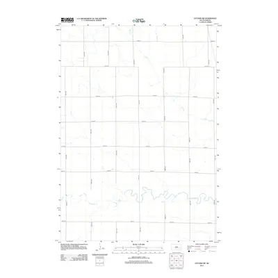
2012 Map of Letcher SW
USGS Topo · Published 2012About this map
Firesteel Creek winds through the southern reaches of this South Dakota landscape, defining the local drainage system alongside the ephemeral Dry Run. The region is organized by a strict section-line road grid, including 401st Ave and 246th St, which facilitates movement across the open agricultural terrain. This 2012 survey illustrates the enduring rural structure of Davison County, where the relationship between the natural waterways and the geometric precision of the township-and-range system remains the primary geographic feature.
Find a feature on this map
16 named features on this map. Tap any name to fly to it.
Don’t see what you’re looking for? This feature index may not catch every label — zoom into the map to look around manually.
Map Details
Editions of this 2012 Letcher SW Map
This is the sole edition of this map. No revisions or reprints were ever made.
Other maps of this area

1899 · Mitchell
USGS Topo · 1:125,000

1955 · Mitchell
USGS Topo · 1:250,000

1957 · Loomis
USGS Topo · 1:24,000

1957 · Letcher NE
USGS Topo · 1:24,000

1957 · Mitchell
USGS Topo · 1:24,000

1959 · Mitchell
USGS Topo · 1:250,000
1979 · Letcher
USGS Topo · 1:24,000
1979 · Letcher SW
USGS Topo · 1:24,000

1979 · Storla
USGS Topo · 1:24,000
1979 · Twin Lakes
USGS Topo · 1:24,000