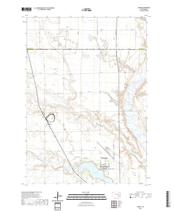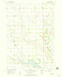
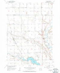
1957 Map of Loomis
USGS Topo · Published 1958About this map
The unincorporated community of Loomis serves as a focal point in this 1957 study of rural Davison County, situated along the Chicago Milwaukee St Paul and Pacific railroad. The landscape is defined by the winding course of the James River to the east and the confluence of Firesteel Creek and Dry Run near Mitchell Lake. This survey illustrates the dense network of rural education that still existed in the mid-century, with numerous one-room schoolhouses such as Titus Sch, Lincoln Sch, and Loomis Sch distributed across the township sections. Near the Mitchell City Boundary, the Mitchell Municipal Airport and a nearby Drive-in Theater signal the mid-century expansion of Mitchell, showing the transition from traditional prairie agriculture to more modern infrastructure and entertainment.
Find a feature on this map
27 named features on this map. Tap any name to fly to it.
Don’t see what you’re looking for? This feature index may not catch every label — zoom into the map to look around manually.
Map Details
Editions of this 1957 Loomis Map
2 editions found
Historical Maps of Mitchell Through Time
5 maps found