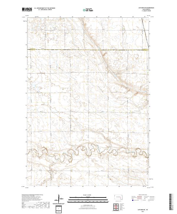
2021 Map of Letcher SW
USGS Topo · Published 2021About this map
Firesteel Creek meanders across the southern reach of this landscape, marking the transition between the agricultural uplands of Sanborn and Davison counties. This modern topographic survey reveals the enduring Public Land Survey System grid that organizes the South Dakota prairie, where a network of section-line roads like 244th St and 400th Ave dictates the movement of people and commerce. The terrain is defined by its subtle drainage patterns, including the intermittent Dry Run, which carves low-lying pathways through the open plains. While primarily rural and focused on large-scale agriculture, the map provides a precise layout of the modern township and range divisions, including t104n r61w and t105n r62w, essential for property research and understanding the contemporary rural infrastructure of the region.
Find a feature on this map
24 named features on this map. Tap any name to fly to it.
Don’t see what you’re looking for? This feature index may not catch every label — zoom into the map to look around manually.
Map Details
Editions of this 2021 Letcher SW Map
This is the sole edition of this map. No revisions or reprints were ever made.
Other maps of this area

1899 · Mitchell
USGS Topo · 1:125,000

1955 · Mitchell
USGS Topo · 1:250,000

1957 · Loomis
USGS Topo · 1:24,000

1957 · Letcher NE
USGS Topo · 1:24,000

1957 · Mitchell
USGS Topo · 1:24,000

1959 · Mitchell
USGS Topo · 1:250,000
1979 · Letcher
USGS Topo · 1:24,000
1979 · Letcher SW
USGS Topo · 1:24,000

1979 · Storla
USGS Topo · 1:24,000
1979 · Twin Lakes
USGS Topo · 1:24,000