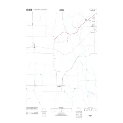
2013 Map of Letts
USGS Topo · Published 2013About this map
Letts and Grandview anchor this section of Muscatine County, where the agricultural uplands transition toward the alluvial lowlands of the Mississippi River valley. The landscape is defined by a dense network of local roads and the prominent path of Highway 61, which bypasses the older town centers. To the east, the terrain shifts significantly as it reaches the Muscatine Slough and the marshy environs of Klum Lake.
Find a feature on this map
67 named features on this map. Tap any name to fly to it.
Don’t see what you’re looking for? This feature index may not catch every label — zoom into the map to look around manually.
Map Details
Editions of this 2013 Letts Map
This is the sole edition of this map. No revisions or reprints were ever made.
Other maps of this area

1946 · Wapello
USGS Topo · 1:62,500

1948 · Muscatine
USGS Topo · 1:62,500

1949 · Wapello
USGS Topo · 1:62,500

1953 · Toolesboro
USGS Topo · 1:24,000

1953 · Blanchard Island
USGS Topo · 1:24,000
1953 · Muscatine
USGS Topo · 1:24,000

1958 · Davenport
USGS Topo · 1:250,000

1961 · Davenport
USGS Topo · 1:250,000

1962 · Davenport
USGS Topo · 1:250,000

1965 · Letts
USGS Topo · 1:24,000