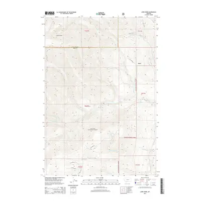
2014 Map of Lewis Creek
USGS Topo · Published 2014About this map
Kotke sits on the eastern edge of this landscape, a lone named point of settlement within the expansive reach of the Gallatin National Forest. The terrain is defined by the high ridges of the Gallatin Range, where a complex network of drainages including Hyalite Creek, Swan Creek, and Big Creek carve through the mountain slopes. The hydrology is diverse, featuring seasonal flows like W Dry Creek B and year-round sources such as Sunny Brook Spring. Notable landforms like Cooper Bench and Little Donahue provide topographic orientation in a region largely dominated by wild forest land. Evidence of forest management is seen in the inclusion of NF-132 Road and Hyalite Creek Road, which provide access to the interior canyons and peaks near the Gallatin and Park County border.
Find a feature on this map
29 named features on this map. Tap any name to fly to it.
Don’t see what you’re looking for? This feature index may not catch every label — zoom into the map to look around manually.
Map Details
Editions of this 2014 Lewis Creek Map
This is the sole edition of this map. No revisions or reprints were ever made.
Other maps of this area

1888 · Three Forks
USGS Topo · 1:250,000

1891 · Livingston
USGS Topo · 1:250,000

1893 · Livingston
USGS Topo · 1:250,000

1894 · Three Forks
USGS Topo · 1:250,000

1895 · Three Forks
USGS Topo · 1:250,000

1947 · Bozeman
USGS Topo · 1:250,000

1948 · Bozeman
USGS Topo · 1:250,000

1955 · Bozeman
USGS Topo · 1:250,000

1955 · Garnet Mountain
USGS Topo · 1:62,500

1955 · Fridley Peak
USGS Topo · 1:62,500