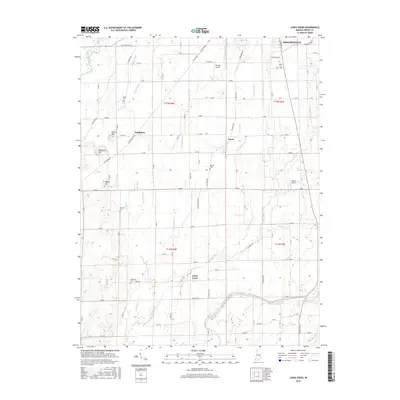
2016 Map of Lewis Creek
USGS Topo · Published 2016About this map
Shelbyville defines the northern edge of this landscape, where the town's residential outskirts transition into the agricultural heart of Shelby County. The terrain is defined by an intricate network of drainage systems, including Roberts Ditch, Howell Ditch, and Thompson Ditch, which channel water toward the south and west. Local family legacies are preserved through numerous small burying grounds scattered across the townships, such as Miller Cem, Tindall Cem, and Patterson Cem. These sites, alongside small settlements like Smithland and Fenns, reflect the persistent rural community structure south of the city.
Find a feature on this map
72 named features on this map. Tap any name to fly to it.
Don’t see what you’re looking for? This feature index may not catch every label — zoom into the map to look around manually.
Map Details
Editions of this 2016 Lewis Creek Map
This is the sole edition of this map. No revisions or reprints were ever made.
Other maps of this area

1942 · Columbus
USGS Topo · 1:125,000

1947 · Hope
USGS Topo · 1:24,000

1948 · Edinburg
USGS Topo · 1:24,000

1948 · Hope
USGS Topo · 1:24,000

1948 · Lewis Creek
USGS Topo · 1:24,000

1948 · Marietta
USGS Topo · 1:24,000

1950 · Edinburg
USGS Topo · 1:62,500

1953 · Shelbyville
USGS Topo · 1:24,000

1953 · Boggstown
USGS Topo · 1:24,000

1953 · Cincinnati
USGS Topo · 1:250,000