
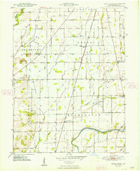
1948 Map of Lewis Creek
USGS Topo · Published 1948About this map
The agricultural landscape of southern Shelby County is defined here by the winding course of the Blue River and the engineered drainage of numerous waterways like Roberts Ditch and Thompson Ditch. Small rural hubs such as Smithland and Lewis Creek anchor the community, connected by the Pennsylvania railroad line that cuts north-south through the center of the sheet. For those researching local family histories, several burial grounds are scattered across the townships, including Tindall Cem, Miller Cem, and Patterson Cem. A significant civic landmark, the County Home, sits near the Shelby Township School on the eastern edge of the survey. The terrain transitions from the lowlands near Flatrock Creek in the south to the distinct rises of McCrea Hill and McFarren Hill in the west, illustrating the topographic variety of the Indiana countryside just after the war.
Find a feature on this map
35 named features on this map. Tap any name to fly to it.
Don’t see what you’re looking for? This feature index may not catch every label — zoom into the map to look around manually.
Map Details
Editions of this 1948 Lewis Creek Map
2 editions found
Other maps of this area

1942 · Columbus
USGS Topo · 1:125,000

1947 · Hope
USGS Topo · 1:24,000

1948 · Edinburg
USGS Topo · 1:24,000

1948 · Hope
USGS Topo · 1:24,000

1948 · Marietta
USGS Topo · 1:24,000

1950 · Edinburg
USGS Topo · 1:62,500

1953 · Shelbyville
USGS Topo · 1:24,000

1953 · Boggstown
USGS Topo · 1:24,000

1953 · Cincinnati
USGS Topo · 1:250,000

1956 · Waldron
USGS Topo · 1:24,000