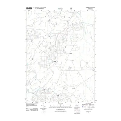
2011 Map of Lewis Run
USGS Topo · Published 2011About this map
Industrial energy production and aviation infrastructure define this portion of McKean County. Significant petroleum operations are evident through the Marshburg Oil Field, the Music Mountain Oil Field, and the Lewis Run Oil Field, illustrating the region's long-standing connection to the oil industry. The eastern portion of the map is dominated by the Bradford Regional Airport near Crawford Junction, while the central corridor follows a series of small settlements and historical stopping points including Taintor, Irishtown, and Timbuck.
Find a feature on this map
55 named features on this map. Tap any name to fly to it.
Don’t see what you’re looking for? This feature index may not catch every label — zoom into the map to look around manually.
Map Details
Editions of this 2011 Lewis Run Map
This is the sole edition of this map. No revisions or reprints were ever made.
Other maps of this area

1924 · Bradford
USGS Topo · 1:62,500

1926 · Bradford
USGS Topo · 1:62,500

1934 · Kane
USGS Topo · 1:48,000

1935 · Mt. Jewett
USGS Topo · 1:48,000

1936 · Kinzua
USGS Topo · 1:48,000

1939 · Kane
USGS Topo · 1:62,500

1940 · Mt. Jewett
USGS Topo · 1:62,500

1941 · Kinzua
USGS Topo · 1:62,500

1941 · Bradford
USGS Topo · 1:62,500

1944 · Bradford
USGS Topo · 1:62,500
Featured Places
- Lafayette Township, PA
- Lewis Run, PA
- Tallyho, Lafayette Township
- Hamlin Township, PA
- Guffey, Hamlin Township