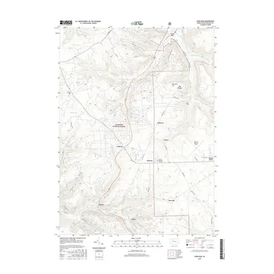
2016 Map of Lewis Run
USGS Topo · Published 2016About this map
Allegheny National Forest dominates the western half of this Pennsylvania landscape, where a dense network of forest roads and creek valleys defines the local geography. The settlement pattern follows the drainage of Lewis Run and its tributaries, with several small communities like Irishtown, Taintor, and Lafayette situated along the primary north-south corridors. In the eastern portion of the map, the Bradford Regional Airport serves as a modern anchor, while smaller settlements such as Guffey and Riterville appear further south. The topography is marked by significant elevation changes, notably at Big Shanty Hill and the deep cuts of Lewis Hollow and Miami Hollow. Historical footprints are preserved in the locations of McKean Memorial Park Cem and the Arch Bridge, offering a detailed view of how transportation and community life integrated with the plateau terrain in the early twenty-first century.
Find a feature on this map
57 named features on this map. Tap any name to fly to it.
Don’t see what you’re looking for? This feature index may not catch every label — zoom into the map to look around manually.
Map Details
Editions of this 2016 Lewis Run Map
This is the sole edition of this map. No revisions or reprints were ever made.
Other maps of this area

1924 · Bradford
USGS Topo · 1:62,500

1926 · Bradford
USGS Topo · 1:62,500

1934 · Kane
USGS Topo · 1:48,000

1935 · Mt. Jewett
USGS Topo · 1:48,000

1936 · Kinzua
USGS Topo · 1:48,000

1939 · Kane
USGS Topo · 1:62,500

1940 · Mt. Jewett
USGS Topo · 1:62,500

1941 · Kinzua
USGS Topo · 1:62,500

1941 · Bradford
USGS Topo · 1:62,500

1944 · Bradford
USGS Topo · 1:62,500
Featured Places
- Lafayette Township, PA
- Lewis Run, PA
- Tallyho, Lafayette Township
- Hamlin Township, PA
- Guffey, Hamlin Township