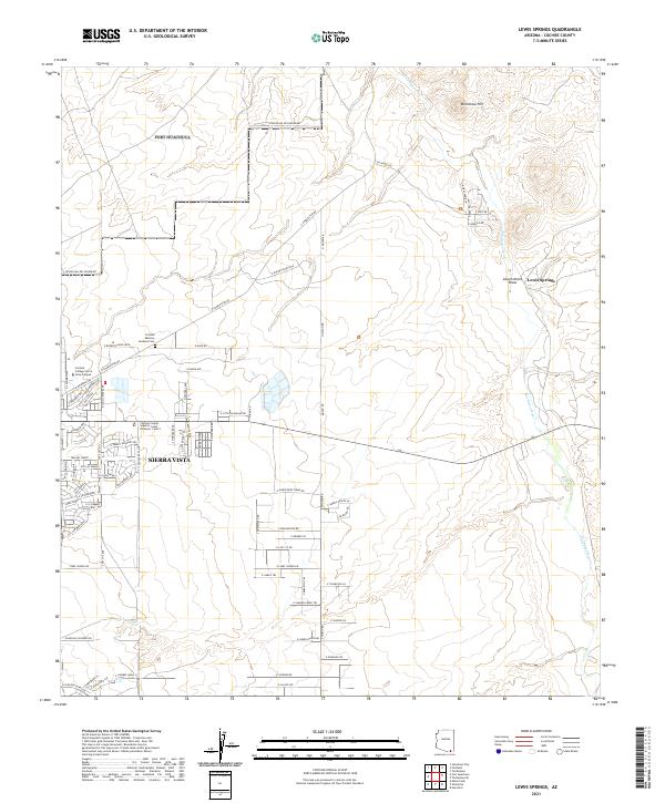
2021 Map of Lewis Springs
USGS Topo · Published 2021About this map
Sierra Vista expansion and the corridor of the San Pedro River characterize this desert landscape in the southern Arizona borderlands. Residential development and institutional growth are evident along the western edge, marked by the Cochise College Sierra Vista Campus and the Cochise County Superior Court Divisions 1 and 4. The map provides a detailed look at the local infrastructure, from the Cochise Memory Gardens Cem to the residential streets of Colonia de Salud. To the east, the terrain transitions into the more open spaces of the San Pedro valley, where geographic features like Brunckow Hill and the Government Draw break the topography. The presence of a Fenced Mil Res Boundary at the northern and western margins indicates the proximity of military land use, while established thoroughfares like E Charleston Rd connect the burgeoning urban areas with the surrounding high desert.
Find a feature on this map
80 named features on this map. Tap any name to fly to it.
Don’t see what you’re looking for? This feature index may not catch every label — zoom into the map to look around manually.
Map Details
Editions of this 2021 Lewis Springs Map
This is the sole edition of this map. No revisions or reprints were ever made.
Other maps of this area

1914 · Hereford
USGS Topo · 1:125,000

1915 · Benson
USGS Topo · 1:125,000

1922 · Sunnyside
USGS Topo · 1:62,500

1932 · Stark
USGS Topo · 1:62,500

1932 · Fairbank
USGS Topo · 1:62,500

1938 · Huachuca
USGS Topo · 1:62,500

1938 · Sunnyside
USGS Topo · 1:62,500

1943 · Benson
USGS Topo · 1:125,000

1948 · Fort Huachuca NE
USGS Topo · 1:24,000

1948 · Miller Peak
USGS Topo · 1:24,000