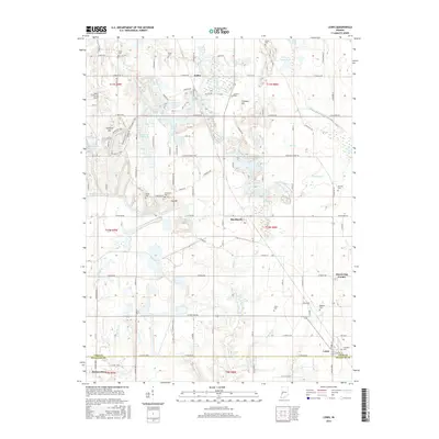
2016 Map of Lewis
USGS Topo · Published 2016About this map
Blackhawk and the surrounding borderlands of Vigo and Sullivan Counties are defined by a complex network of small waterways and family-named cemeteries. The legendary Wabash and Erie Canal cuts across the northeastern corner, a silent marker of 19th-century infrastructure that once transformed the region's economy. The landscape is dotted with localized settlements like Keller and Lewis, as well as distinctive geographic markers such as Trimmer Hill and Yaw Hill.
Find a feature on this map
70 named features on this map. Tap any name to fly to it.
Don’t see what you’re looking for? This feature index may not catch every label — zoom into the map to look around manually.
Map Details
Editions of this 2016 Lewis Map
This is the sole edition of this map. No revisions or reprints were ever made.
Other maps of this area

1908 · Clay City
USGS Topo · 1:48,000

1910 · Clay City
USGS Topo · 1:62,500

1940 · Lewis
USGS Topo · 1:24,000

1940 · Jasonville
USGS Topo · 1:24,000

1940 · Pimento
USGS Topo · 1:24,000

1941 · Seelyville
USGS Topo · 1:24,000

1941 · Terre Haute
USGS Topo · 1:24,000

1942 · Shelburn
USGS Topo · 1:24,000

1943 · Hymera
USGS Topo · 1:24,000

1948 · Terre Haute
USGS Topo · 1:24,000