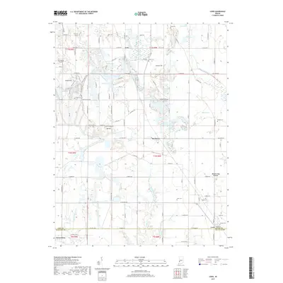
2019 Map of Lewis
USGS Topo · Published 2019About this map
Lewis and Blackhawk anchor this section of the Indiana countryside along the border of Vigo and Sullivan Counties. The landscape is a network of agricultural fields and water-filled remnants of former industrial activity, including several named lakes such as Wonder Lake, Lee Lake, and Israel Lake. A historical trace of the Wabash and Erie Canal is visible in the northeastern corner, marking the enduring impact of nineteenth-century transportation infrastructure on the local geography. Numerous family cemeteries, including Jones, Miner, and Liberty, are scattered across the terrain, offering significant points of interest for genealogical research. Small settlements like Keller and Brown Jug Corner provide additional context for the area's rural development. To the west, the Aero Plaines Airport and a series of recreation paths like the Perimeter Trail suggest the modern usage of the land surrounding Sanford Hill.
Find a feature on this map
104 named features on this map. Tap any name to fly to it.
Don’t see what you’re looking for? This feature index may not catch every label — zoom into the map to look around manually.
Map Details
Editions of this 2019 Lewis Map
This is the sole edition of this map. No revisions or reprints were ever made.
Other maps of this area

1908 · Clay City
USGS Topo · 1:48,000

1910 · Clay City
USGS Topo · 1:62,500

1940 · Lewis
USGS Topo · 1:24,000

1940 · Jasonville
USGS Topo · 1:24,000

1940 · Pimento
USGS Topo · 1:24,000

1941 · Seelyville
USGS Topo · 1:24,000

1941 · Terre Haute
USGS Topo · 1:24,000

1942 · Shelburn
USGS Topo · 1:24,000

1943 · Hymera
USGS Topo · 1:24,000

1948 · Terre Haute
USGS Topo · 1:24,000