
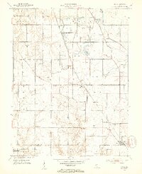
1940 Map of Lewis
USGS Topo · Published 1940About this map
The coal-rich landscape of Vigo and Sullivan counties emerges in this late 1930s survey, defined by the industrial activity around Blackhawk and the surrounding strip mines. The southern portion of the sheet features the rural crossroads of Farmersburg and Lewis, where the Chicago and Eastern Illinois and Chicago Milwaukee St Paul and Pacific railroads intersect the agricultural terrain. A unique social landmark, the Blue Ribbon Racetrack, sits just west of the Blackhawk Mine, illustrating the local recreation patterns of the era.
Find a feature on this map
48 named features on this map. Tap any name to fly to it.
Don’t see what you’re looking for? This feature index may not catch every label — zoom into the map to look around manually.
Map Details
Editions of this 1940 Lewis Map
This is the sole edition of this map. No revisions or reprints were ever made.
Other maps of this area

1908 · Clay City
USGS Topo · 1:48,000

1910 · Clay City
USGS Topo · 1:62,500

1940 · Jasonville
USGS Topo · 1:24,000

1940 · Pimento
USGS Topo · 1:24,000

1941 · Seelyville
USGS Topo · 1:24,000

1941 · Terre Haute
USGS Topo · 1:24,000

1942 · Shelburn
USGS Topo · 1:24,000

1943 · Hymera
USGS Topo · 1:24,000

1948 · Terre Haute
USGS Topo · 1:24,000
1952 · Lewis
USGS Topo · 1:24,000