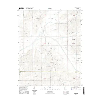
2015 Map of Lewisburg
USGS Topo · Published 2015About this map
Lewisburg and Cockrum anchor this northern Mississippi landscape, where the Coldwater River and its intricate network of tributaries define the terrain. The area is characterized by small, established communities and a significant density of family-oriented burial grounds, including the Drain Family Cem and Mills Family Cem, which offer valuable points of reference for genealogists. The presence of Valden Landing Airport and the Holloway Bridge indicates how the local transportation infrastructure has adapted to the winding river system. Water management is evident through the Byhalia Creek Canal and Red Banks Creek Canal, showing a history of land use and drainage efforts in the region. Towards the south, the boundary between DeSoto and Tate counties marks a transition near Alphaba, while the winding courses of Pigeon-Roost Creek and Beartail Cr dominate the local hydrology.
Find a feature on this map
95 named features on this map. Tap any name to fly to it.
Don’t see what you’re looking for? This feature index may not catch every label — zoom into the map to look around manually.
Map Details
Editions of this 2015 Lewisburg Map
This is the sole edition of this map. No revisions or reprints were ever made.
Other maps of this area

1944 · Senatobia
USGS Topo · 1:62,500

1944 · Hernando
USGS Topo · 1:62,500

1944 · Tyro
USGS Topo · 1:62,500

1948 · Byhalia
USGS Topo · 1:62,500

1956 · Tupelo
USGS Topo · 1:250,000

1958 · Tupelo
USGS Topo · 1:250,000
1971 · Byhalia
USGS Topo · 1:24,000

1971 · Wyatte
USGS Topo · 1:24,000
1971 · Byhalia NW
USGS Topo · 1:24,000
1975 · Senatobia NW
USGS Topo · 1:24,000