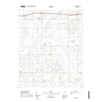
2021 Map of Lewisburg
USGS Topo · Published 2021About this map
Lewisburg and the surrounding North Mississippi countryside are defined by the winding course of the Coldwater River and its managed tributaries. This modern survey illustrates the rural landscape near the border of DeSoto and Tate counties, where family legacies are preserved in numerous small burial grounds such as Whites Chapel Cem, Fountain Head Cem, and the Drain Family Cem. The map reveals a transition from traditional settlements like Cockrum and Ingrams Mill to more contemporary residential developments indicated by the dense network of private drives and lanes branching off historical routes like Byhalia Rd. Water management is a prominent theme, visible in the straightened segments of the Byhalia Creek Canal and Red Banks Creek Canal, which facilitate drainage across the low-lying plains near the Co Line Rd.
Find a feature on this map
116 named features on this map. Tap any name to fly to it.
Don’t see what you’re looking for? This feature index may not catch every label — zoom into the map to look around manually.
Map Details
Editions of this 2021 Lewisburg Map
This is the sole edition of this map. No revisions or reprints were ever made.
Other maps of this area

1944 · Senatobia
USGS Topo · 1:62,500

1944 · Hernando
USGS Topo · 1:62,500

1944 · Tyro
USGS Topo · 1:62,500

1948 · Byhalia
USGS Topo · 1:62,500

1956 · Tupelo
USGS Topo · 1:250,000

1958 · Tupelo
USGS Topo · 1:250,000
1971 · Byhalia
USGS Topo · 1:24,000

1971 · Wyatte
USGS Topo · 1:24,000
1971 · Byhalia NW
USGS Topo · 1:24,000
1975 · Senatobia NW
USGS Topo · 1:24,000