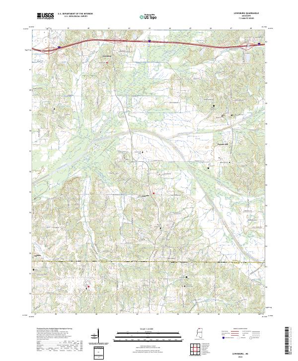
2024 Map of Lewisburg
USGS Topo · Published 2024About this map
Lewisburg and Cockrum anchor this agricultural landscape in northern Mississippi, where the headwaters and tributaries of the Coldwater River carve through the terrain. The map reveals a dense network of family and community history through its numerous small burial grounds, such as the Drain Family Cem and the Mills Family Cem. Near the center of the sheet, the settlement of Cockrum serves as a local crossroads, while to the southeast, Ingrams Mill sits along the Pigeon Roost Creek. The southern portion of the quadrangle marks the transition at the DeSoto Co Tate Co line. This survey is particularly useful for genealogists, as it identifies scattered landmarks like the New Hope Church Cem and Pryor Cem, preserving the location of rural congregations and family plots that defined the social geography of the region for generations.
Find a feature on this map
106 named features on this map. Tap any name to fly to it.
Don’t see what you’re looking for? This feature index may not catch every label — zoom into the map to look around manually.
Map Details
Editions of this 2024 Lewisburg Map
This is the sole edition of this map. No revisions or reprints were ever made.
Other maps of this area

1944 · Senatobia
USGS Topo · 1:62,500

1944 · Hernando
USGS Topo · 1:62,500

1944 · Tyro
USGS Topo · 1:62,500

1948 · Byhalia
USGS Topo · 1:62,500

1956 · Tupelo
USGS Topo · 1:250,000

1958 · Tupelo
USGS Topo · 1:250,000
1971 · Byhalia
USGS Topo · 1:24,000

1971 · Wyatte
USGS Topo · 1:24,000
1971 · Byhalia NW
USGS Topo · 1:24,000
1975 · Senatobia NW
USGS Topo · 1:24,000