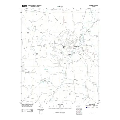
2010 Map of Lewisburg
USGS Topo · Published 2010About this map
Lewisburg serves as the central hub of this Tennessee landscape, anchored by the Lewisburg Post Office and the residential neighborhoods of Fairview and Forest Hills. The map reveals a distinct agricultural and utility-focused infrastructure, most notably the United State Experimental Dairy Farm south of the city center. This specialized facility, alongside the Lewisburg Reservoir and its associated Lewisburg Reservoir Dam, illustrates the organized management of land and water resources in Marshall County during the early 21st century.
Find a feature on this map
150 named features on this map. Tap any name to fly to it.
Don’t see what you’re looking for? This feature index may not catch every label — zoom into the map to look around manually.
Map Details
Editions of this 2010 Lewisburg Map
This is the sole edition of this map. No revisions or reprints were ever made.
Other maps of this area

1936 · Farmington
USGS Topo · 1:24,000

1936 · Belfast
USGS Topo · 1:24,000

1936 · Cornersville
USGS Topo · 1:24,000

1936 · Lewisburg
USGS Topo · 1:24,000

1936 · Brick Church
USGS Topo · 1:24,000

1936 · Verona
USGS Topo · 1:24,000

1936 · Campbells Station
USGS Topo · 1:24,000

1936 · Petersburg
USGS Topo · 1:24,000

1936 · Glendale
USGS Topo · 1:24,000

1944 · Shelbyville
USGS Topo · 1:100,000