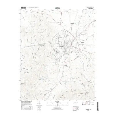
2016 Map of Lewisburg
USGS Topo · Published 2016About this map
Lewisburg serves as the central hub for this 2016 Marshall County survey, surrounded by established neighborhoods like Lincoln Park, Forest Hills, and Hickory Heights. The landscape is a complex network of springs and drainage, featuring historically significant water sources such as Old Distillery Spring, Old Marshall Academy Spring, and Vickrey Spring. To the south, the Lewisburg Reservoir on New Lake Br indicates the critical infrastructure managing the local water supply.
Find a feature on this map
228 named features on this map. Tap any name to fly to it.
Don’t see what you’re looking for? This feature index may not catch every label — zoom into the map to look around manually.
Map Details
Editions of this 2016 Lewisburg Map
This is the sole edition of this map. No revisions or reprints were ever made.
Other maps of this area

1936 · Farmington
USGS Topo · 1:24,000

1936 · Belfast
USGS Topo · 1:24,000

1936 · Cornersville
USGS Topo · 1:24,000

1936 · Lewisburg
USGS Topo · 1:24,000

1936 · Brick Church
USGS Topo · 1:24,000

1936 · Verona
USGS Topo · 1:24,000

1936 · Campbells Station
USGS Topo · 1:24,000

1936 · Petersburg
USGS Topo · 1:24,000

1936 · Glendale
USGS Topo · 1:24,000

1944 · Shelbyville
USGS Topo · 1:100,000