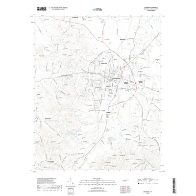
2019 Map of Lewisburg
USGS Topo · Published 2019About this map
Lewisburg serves as the central hub of this Marshall County landscape, surrounded by a ring of established neighborhoods including Lincoln Park, Wallace Acres, and Needmore. The terrain is defined by its deep connectivity to water, with Big Rock Creek and its many tributaries like Goose Creek and Silver Creek carving through the limestone-rich valleys. Notable for genealogists is the high density of family burial grounds and small cemeteries such as Welch Cemetery and Endsley Cemetery that dot the countryside, particularly around South Berlin and the southern reaches near Cornersville. Significant landmarks include the Lewisburg Reservoir and the Old Marshall Academy Spring, reflecting the area's long-standing reliance on local spring-fed resources. To the west, the landscape transitions into more varied relief, marked by the prominent Baxter Ridge and Wilson Hill, where smaller settlements like Globe and Duncanville maintain a quieter, rural character.
Find a feature on this map
226 named features on this map. Tap any name to fly to it.
Don’t see what you’re looking for? This feature index may not catch every label — zoom into the map to look around manually.
Map Details
Editions of this 2019 Lewisburg Map
This is the sole edition of this map. No revisions or reprints were ever made.
Other maps of this area

1936 · Farmington
USGS Topo · 1:24,000

1936 · Belfast
USGS Topo · 1:24,000

1936 · Cornersville
USGS Topo · 1:24,000

1936 · Lewisburg
USGS Topo · 1:24,000

1936 · Brick Church
USGS Topo · 1:24,000

1936 · Verona
USGS Topo · 1:24,000

1936 · Campbells Station
USGS Topo · 1:24,000

1936 · Petersburg
USGS Topo · 1:24,000

1936 · Glendale
USGS Topo · 1:24,000

1944 · Shelbyville
USGS Topo · 1:100,000