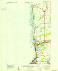
1950 Map of Lewiston
USGS Topo · Published 1950About this map
The Niagara River marks the western edge of this 1950 survey, defining the international boundary between New York and Ontario. The landscape is dominated by the strategic corridor between Youngstown and Niagara Falls, where the high ground of Rumsey Ridge overlooks the river's lower reaches. This post-war period captures a region defined by institutional growth and established agriculture, with several major educational and religious sites including the Stella Niagara Seminary and the Niagara University campus near Devils Hole Rapids.
Find a feature on this map
45 named features on this map. Tap any name to fly to it.
Don’t see what you’re looking for? This feature index may not catch every label — zoom into the map to look around manually.
Map Details
Editions of this 1950 Lewiston Map
This is the sole edition of this map. No revisions or reprints were ever made.
Other maps of this area

1894 · Niagara Falls
USGS Topo · 1:62,500

1894 · Wilson
USGS Topo · 1:62,500

1896 · Niagara Falls
USGS Topo · 1:62,500

1897 · Tonawanda
USGS Topo · 1:62,500

1899 · Niagara
USGS Topo · 1:125,000

1900 · Wilson
USGS Topo · 1:62,500

1900 · Tonawanda
USGS Topo · 1:62,500

1900 · Niagara Falls
USGS Topo · 1:62,500

1901 · Niagara Falls
USGS Topo · 1:62,500

1901 · Tonawanda
USGS Topo · 1:62,500