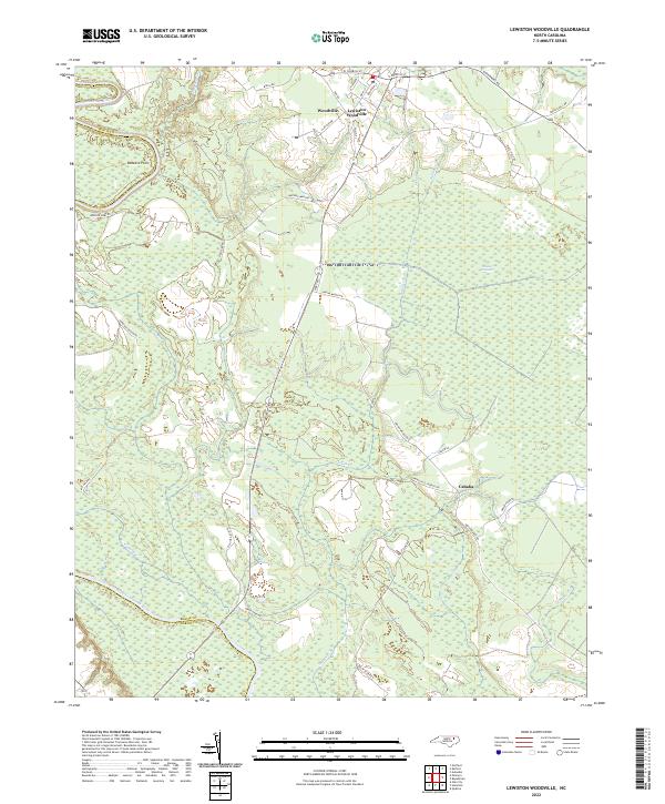
2022 Map of Lewiston Woodville
USGS Topo · Published 2022About this map
The Roanoke River forms the western boundary of this landscape, carving through the lowlands where the borders of Bertie, Halifax, and Martin counties meet. The twin communities of Woodville and Lewiston Woodville serve as the primary northern settlements, connected by a network of local roads such as Weeping Mary Rd and Governors Rd. The interior of the quadrangle is defined by expansive wetlands and watercourses, including the notable Roquist Pocosin and the winding path of Indian Cr.
Find a feature on this map
40 named features on this map. Tap any name to fly to it.
Don’t see what you’re looking for? This feature index may not catch every label — zoom into the map to look around manually.
Map Details
Editions of this 2022 Lewiston Woodville Map
This is the sole edition of this map. No revisions or reprints were ever made.
Other maps of this area

1901 · Parmele
USGS Topo · 1:62,500

1901 · Williamston
USGS Topo · 1:62,500

1902 · Williamston
USGS Topo · 1:62,500

1902 · Parmele
USGS Topo · 1:62,500

1953 · Norfolk
USGS Topo · 1:250,000

1953 · Rocky Mount
USGS Topo · 1:250,000

1954 · Rocky Mount
USGS Topo · 1:250,000
1962 · Palmyra
USGS Topo · 1:24,000
1962 · Norfleet
USGS Topo · 1:24,000
1972 · Republican
USGS Topo · 1:24,000