Old Maps of Martin County, North Carolina
Explore 130 old maps of Martin County, spanning from 1901 to today. These high-resolution historic maps reveal how streets, neighborhoods, landmarks, and natural features evolved over time — perfect for genealogy, metal detecting, research, and local history exploration.
What you can do with these maps:
- See how Martin County changed over time: Compare historical maps to modern-day views to trace roads, homesites, rail lines & more.
- View detailed metadata: Each map includes creators, publishers, year, scale, and archive source.
- Overlay maps with satellite & LiDAR: Visualize the past alongside modern tools to explore terrain & human change.
- Trusted historical sources: Maps sourced from the USGS, Library of Congress, and other archives.
- Access maps your way: View online, download high-res files, or order prints for personal or research use.
Start exploring old maps of Martin County to uncover forgotten places, hidden landmarks, and the deep history beneath your feet.
Martin County, NC maps
(130)- 1901 Map of Parmele, 1971 Print
 1901 Parmele1971 Print · USGSCoastal plain North Carolina at the turn of the century is defined here by the converging tracks at Parmele and the dense swampy lowlands. Genealogists can trace early homesteads and community hubs like Shiloh Mills, Dogtown, and the old Tram Road.
 - 1901 Map of Williamston, 1972 Print
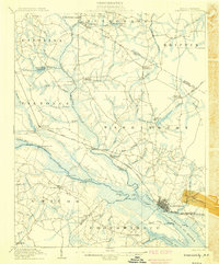
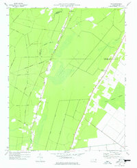
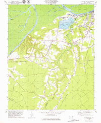
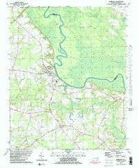
 1901 Williamston1972 Print · USGSThe Roanoke River basin at the turn of the century shows a thriving network of steamboat landings and new rail lines. Genealogists and researchers can trace the river economy through Spellers Ferry Landing, Grabtown, and the Atlantic Coast Line R. R.
 - 1902 Map of Williamston, 1944 Print
 1902 Williamston1944 Print · USGSMartin County’s riverfront and rail corridors are frozen in time here at the dawn of the twentieth century. Genealogists and local historians can trace family roots through landings like Spellers Ferry Landing or settlements at Everetts and Goldpoint.
 - 1902 Map of Parmele, 1959 Print
 1902 Parmele1959 Print · USGSCoastal Plain North Carolina at the turn of the century shows a landscape defined by the arrival of the railroad. Genealogists and local historians can trace family roots in early settlements like Conetoe, Shiloh Mills, and the rail junction at Parmele.
 - 1903 Map of Chocowinity, 1968 Print
 1903 Chocowinity1968 Print · USGSCoastal North Carolina comes alive in the early 1900s as steam power and rail lines intersect along the banks of the Tar River. Researchers can trace old river landings like Yankee Hall Ldg. and family-named landmarks including Woolard Crossroads and Shepherd Millpond.
 - 1905 Map of Chocowinity
 1905 Chocowinity1905 Print · USGSCoastal North Carolina during the early 1900s centered on the busy waterways of the Tar River and the growing town of Washington. Genealogists and historians can trace old river landings such as Yankee Hall Ldg. and rural sites like Leggetts Crossroads or Pactolus.3 unique versions available
 - 1943 Map of Plymouth
 1943 Plymouth1943 Print · USGSThe coastal plains and swamps of eastern North Carolina are captured here during the wartime era, showing a landscape defined by river navigation and drainage canals. Genealogists can trace family roots through rural landmarks like Ellis Store, St Lukes Ch, and small rail stops such as Acre Sta.
 - 1953 Map of Norfolk, 1954 Print
 1953 Norfolk1954 Print · USGSCoastal Virginia and northeastern North Carolina appear here during the post-war industrial boom, showing the critical rail-and-sea connections of Hampton Roads. Genealogists can trace family roots through rural landmarks like Gethsemane Ch, the Caledonia State Prison Farm, and the vast interior of the Dismal Swamp.4 unique versions available
 - 1953 Map of Rocky Mount, 1964 Print
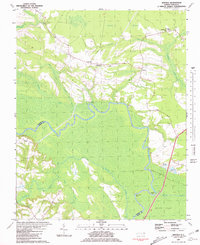
 1953 Rocky Mount1964 Print · USGSEastern North Carolina in the mid-fifties is defined by its deep river basins and the vast wetlands of the Tidewater. Genealogists can trace family roots through hubs like Kinston and New Bern or explore the wilderness of Pettigrew State Park and Lake Mattamuskeet.4 unique versions available
 - 1954 Map of Rocky Mount
 1954 Rocky Mount1954 Print · USGSEastern North Carolina is mapped in the mid-fifties, showing a landscape of sounds, swamps, and steam-era rail lines. Genealogists can trace the rural road networks and rail spurs connecting towns like Tarboro, Greenville, and the remote Columbia.
 - 1962 Map of Palmyra, 1964 Print
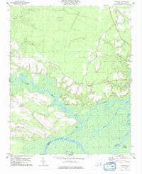
 1962 Palmyra1964 Print · USGSCoastal plain farming and river bottomlands meet along the Roanoke River in the early sixties. Genealogists can locate family-named sites like Stephenson Cem and Mizell Cem or trace the rural route of the Atlantic Coast Line.
 - 1962 Map of Hobgood, 1964 Print
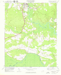
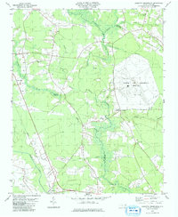
 1962 Hobgood1964 Print · USGSThe rural landscape of Halifax and Edgecombe counties is captured here in the early sixties, centered on the railroad town of Hobgood. Researchers can trace old family sites and rural landmarks like the Leggett House Cem, Shield Sch, and Kehukee Ch.2 unique versions available
 - 1972 Map of Woodville, 1976 Print
 1972 Woodville1976 Print · USGSBertie County in the early 1970s is a landscape of expansive wetlands and small railroad towns. Genealogists and historians can trace the footprint of rural communities through sites like Bond Sch, Spring Hill Ch, and the SCL RR rail line.
 - 1978 Map of Farmlife
 1978 Farmlife1978 Print · USGSThe Martin and Beaufort county line area is captured here during the late 1970s, showcasing a landscape of timber tracts and small rural communities. Genealogists can locate family landmarks such as Manning Cem, Maple Grove Ch, and the Manning Farmlife Sch.
 - 1978 Map of Hoke
 1978 Hoke1978 Print · USGSCoastal North Carolina's timber and rail country is captured here during the mid-seventies, showing the intersection of Beaufort and Washington counties. Genealogists can locate family burial sites along Long Ridge Road and historic congregations like Christian Hope Ch.
 - 1978 Map of Jamesville, 1979 Print
 1978 Jamesville1979 Print · USGSJamesville and the banks of the Roanoke River are captured here in the late seventies as the region maintained its traditional riverfront and rail character. Genealogists and local historians can trace family locations and rural congregations like St James Ch and Siloam Ch near the Seaboard Coast Line.
 - 1978 Map of Windsor South, 1979 Print
 1978 Windsor South1979 Print · USGSCoastal North Carolina's riverine landscape is captured here in the late seventies, centered on the historic crossroads of Bertie County. Researchers can trace rural life through landmarks like Millers Store, Hillcrest Cem, and Cedar Landing along the riverbanks.
 - 1979 Map of Plymouth West
 1979 Plymouth West1979 Print · USGSThe Roanoke River lowlands and the industrial outskirts of Plymouth come into focus during the mid-1970s. Trace local history through the many rural churches and rail lines like Union Town Ch, Wares Chapel, and the Seaboard Coast Line.2 unique versions available
 - 1979 Map of Woodard
 1979 Woodard1979 Print · USGSThe Bertie County river country is captured here in the late seventies, showing a landscape defined by the Cashie River. Local historians can trace the Sans Souci Ferry and several rural congregations like Cashie Ch and St Pauls Ch.
 - 1979 Map of Leggetts Crossroads
 1979 Leggetts Crossroads1979 Print · USGSPitt and Beaufort counties were characterized by vast wetlands and international broadcasting infrastructure in the late 1970s. Researchers can locate dozens of family cemeteries and rural landmarks like the Voice of America (Site A) facility and Pactolus.
 - 1981 Map of Quitsna
 1981 Quitsna1981 Print · USGSThe Roanoke River floodplain in Bertie County is shown here in the early eighties, characterized by its winding oxbows and deep swamp forests. Local historians can trace riverside landings like Coniott Landing and quiet crossroads churches such as Siloam Ch and Indian Woods Ch.
 - 1981 Map of Speed
 1981 Speed1981 Print · USGSEdgecombe County at the dawn of the eighties reveals a landscape of railroad towns and riverfront hamlets shaped by the Tar River. Genealogists can locate family landmarks such as White Chapel, Roberson Sch, and the rural community of Coakley.2 unique versions available
 - 1981 Map of Robersonsville West
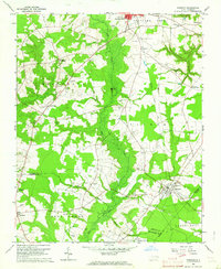
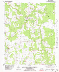
 1981 Robersonsville West1981 Print · USGSCoastal plain settlements and railroad junctions define this 1980s landscape across the Pitt and Martin county lines. Genealogists and historians can trace family roots through numerous unnamed cemeteries and community hubs like Parmele, Hickory Grove Ch, and the Seaboard Coast Line tracks.
 - 1981 Map of Hamilton
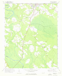
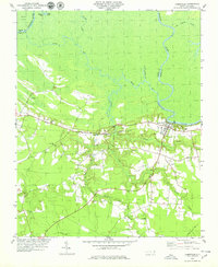
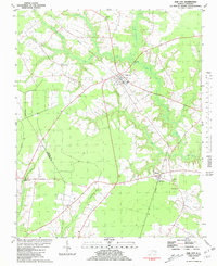
 1981 Hamilton1981 Print · USGSThe Roanoke River basin in eastern North Carolina was home to tight-knit rural communities in the early 1980s. Genealogists and historians can locate numerous country landmarks like Spring Green Ch, the Edna Andrews Sch, and the small settlement of Huskanaw.2 unique versions available
 - 1981 Map of Oak City
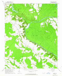
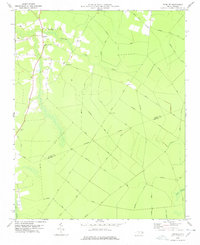
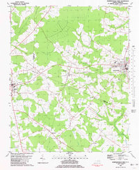
 1981 Oak City1981 Print · USGSIn the early 1980s, this area of Martin County was defined by its railroad hamlets and extensive swamp drainage systems. Researchers can locate many rural landmarks including Merritts Chapel, the Lookout Tower, and cemeteries near Hassell and Oak City.
Showing maps 1-25 of 130
Top cities of Martin County
- Williamston historical maps
- Robersonville historical maps
- Hamilton historical maps
- Jamesville historical maps
- Oak City historical maps
- Parmele historical maps
See more
Frequently asked questions
- What are the different types of historical maps available for Martin County?
- What is the oldest map of Martin County?
- Where can I purchase historical maps of Martin County for my home or office?
- Where can I download high-res historical maps of Martin County?
- Are there historical topographic maps available for Martin County?
- Is there historical aerial imagery available for Martin County?
- Where are historical maps of Martin County sourced from?