1960s Maps of Martin County, North Carolina
Explore 2 historic maps of Martin County from the 1960s. These maps offer a rare glimpse into what life looked like during the 1960s — showing old roads, neighborhoods, homes, and landmarks that have changed or disappeared over time.
Whether you're researching your family's past, planning a metal detecting trip, or studying how Martin County's landscape evolved across the 1960s, these high-resolution maps are a powerful tool for exploring the history of this region.
- Focus on a specific era: All maps on this page are from the 1960s, giving you a focused view of this time period.
- See what’s changed: Compare century-old streets, trails, and buildings to today's modern landscape using overlays and satellite layers.
- Research with precision: Use these maps for genealogy, historical research, land use analysis, or educational projects.
- View, download, or print: Maps are fully viewable online in high resolution, and can be downloaded or printed for your own records.
Start exploring Martin County's history through authentic maps from the 1960s. This is your window into the past.
Martin County, NC maps
(2)- 1962 Map of Palmyra, 1964 Print
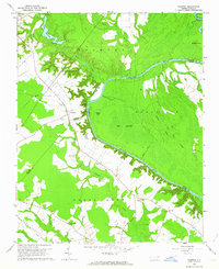 1962 Palmyra1964 Print · USGSCoastal plain farming and river bottomlands meet along the Roanoke River in the early sixties. Genealogists can locate family-named sites like Stephenson Cem and Mizell Cem or trace the rural route of the Atlantic Coast Line.
 - 1962 Map of Hobgood, 1964 Print
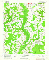 1962 Hobgood1964 Print · USGSThe rural landscape of Halifax and Edgecombe counties is captured here in the early sixties, centered on the railroad town of Hobgood. Researchers can trace old family sites and rural landmarks like the Leggett House Cem, Shield Sch, and Kehukee Ch.2 unique versions available
End of results
Showing maps 1-2 of 2
Top cities of Martin County
- Williamston historical maps
- Robersonville historical maps
- Hamilton historical maps
- Jamesville historical maps
- Oak City historical maps
- Parmele historical maps
See more
Frequently asked questions
- What are the different types of historical maps available for Martin County?
- What is the oldest map of Martin County?
- Where can I purchase historical maps of Martin County for my home or office?
- Where can I download high-res historical maps of Martin County?
- Are there historical topographic maps available for Martin County?
- Is there historical aerial imagery available for Martin County?
- Where are historical maps of Martin County sourced from?