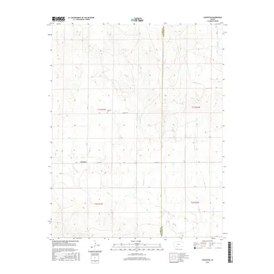
2016 Map of Lexington
USGS Topo · Published 2016About this map
The small community of Lexington serves as the focal point of this southwestern Kansas landscape, situated along the border of Clark and Comanche Counties. The settlement pattern is defined by a traditional sectional grid, where routes like Old Hwy 34 and Cemetery Rd provide access to the rural homesteads. This area is characterized by a complex drainage network, with Bluff Cr winding across the southern sections while Cavalry Cr and Nichols Cr carve northward through the terrain. Genealogists and local researchers will find the Lexington Cem north of the main settlement, a primary landmark for tracing family roots in this corner of the state. The convergence of numerous named waterways, including Lone Tree Cr and Buzzard Cr, illustrates the hydrological importance of the region's draws and creek beds to the local agricultural economy.
Find a feature on this map
30 named features on this map. Tap any name to fly to it.
Don’t see what you’re looking for? This feature index may not catch every label — zoom into the map to look around manually.
Map Details
Editions of this 2016 Lexington Map
This is the sole edition of this map. No revisions or reprints were ever made.
Other maps of this area

1892 · Coldwater
USGS Topo · 1:125,000

1894 · Sitka
USGS Topo · 1:62,500

1896 · Ashland
USGS Topo · 1:125,000

1955 · Pratt
USGS Topo · 1:250,000

1959 · Pratt
USGS Topo · 1:250,000

1979 · Sitka
USGS Topo · 1:24,000

1979 · Sugarloaf
USGS Topo · 1:24,000

1979 · Turkey Creek
USGS Topo · 1:24,000

1979 · East Kiowa Creek South
USGS Topo · 1:24,000
1979 · East Kiowa Creek North
USGS Topo · 1:24,000